Chinese GPS earned in test mode
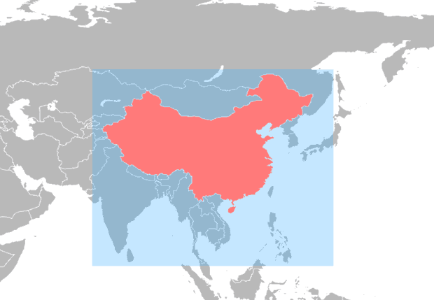
Coverage area of satellite navigation system Beidou
The Chinese began the test operation of their own satellite navigation system Beidou. Like the Russian GLONASS, it is conceived as an alternative to the American GPS, but at the same time compatible with it, providing more accurate positioning when using satellite signals of both systems at once.
At the moment, the Beidou constellation includes only ten satellites that cover China and adjacent territories, including the Russian Far East and border areas. Specifically, the signal is received in a square between 84 ° and 160 ° east longitude and between 55 ° north latitude and 55 ° south latitude.
The timing of the Beidou signals is now 50 nanoseconds, the positioning accuracy is 25 meters. During 2012, it is planned to add six more satellites and bring the accuracy to 10 meters. At the same time, the Beidou coverage area will spread to most countries of Southeast Asia.
')
The Beidou constellation will grow to a full-time 35 satellites by 2020, and then it will be able to compete worldwide with GPS, GLONASS and European Galileo. Unlike all other positioning systems, Beidou satellites have a dual purpose and simultaneously operate as communication satellites. Due to additional revenues from telecommunications services, the cost of operating the entire system is reduced.
Source: https://habr.com/ru/post/135377/
All Articles