Car navigation in detail
This article is for those who are going to buy a car navigator in the near future, but lacks information.
Using the example of a typical Lexand Si-515 Pro HD navigator, I will try to tell you in detail what is being offered on the market for such devices.
')
I will also describe the impressions of the three tested navigation systems, with one of which I traveled in June about three thousand kilometers through two countries.
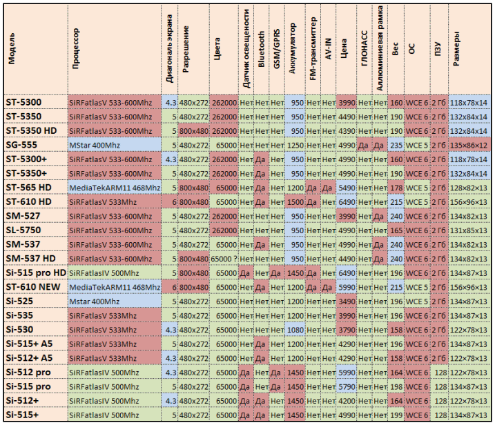
And at the end of the article I will give a large comparative table of 23 current models of Lexand navigators to show what the capabilities of these devices may be.
The choice is now quite large. Prices and features, thanks to the competition, are not so different. As a rule, the purchase is interested in the reliability and convenience of the device. At the same time, the functionality and relevance of maps is 100% determined by the installed navigation system. Therefore, it is very important to be able to easily update it, and even better if you can run several different ones.
Characteristics and equipment
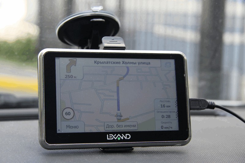
So, the mentioned navigator works on Windows CE 6.0, has a 5-inch high resolution screen 800x480, a SiRFatlasIV 500Mhz processor, 128 MB RAM, a 2GB ROM, an external micro SD memory card, a slim 13 mm case, and a SIM card slot.
Standard equipment: navigator, holder on the glass, stylus, charging from the cigarette lighter, USB cable, manual. A nice bonus is a soft case.
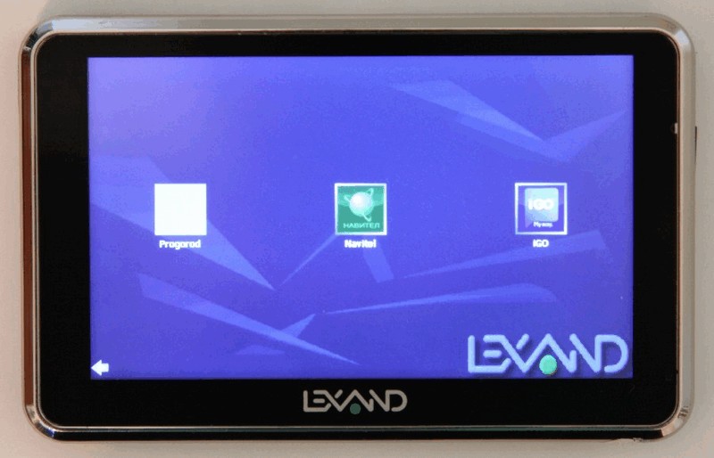
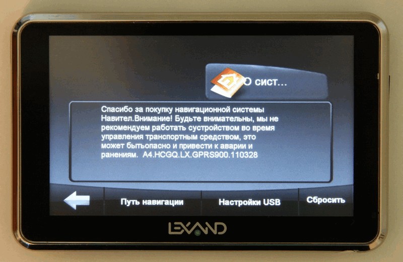
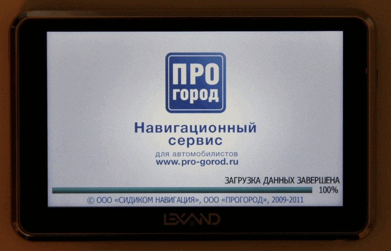
It is delivered traditionally with one of three options of navigation systems: “Navitel Navigator”, “PROGOROD” or “Citigid”. My first and second tests were installed on the test, plus I additionally installed iGo.
Preparing the navigator for the trip
As is usually the case, the time for gathering was just barely enough, so I was in a hurry trying to check the performance of the navigator on the last night before leaving. And, as if on purpose, my USB connection refused to work that day. As I later understood, most likely due to poor-quality USB-cable. In this regard, access to the internal memory could not be obtained. And since Navitel was recorded in the ROM, and not on the external map, I could not fully update it.
However, Lexand navigators are good because they allow you to run any navigation program by simply specifying the path to the executable file. Therefore, I wrote down a proven iGo 8 on a micro-SD card, which I had previously successfully used on a PDA and on another Lexand ST-610 , and tried to launch it. But even here I was waiting for a surprise - the program dropped with the Access violation message. In a hurry, I tried several versions, and they all refused to work with similar symptoms. It is likely that the problem is simple and related to the settings for working at 800x480, but there was no time to find out.
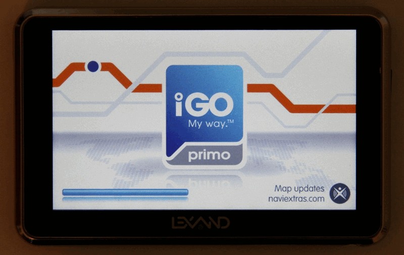
There was the last option - try the new iGo Primo. I didn't really trust her, because The program is new, demanding of the gland and, as I initially assumed, is not very stable.
But luck was waiting here - everything started on the first try! The system turned out to be so beautiful and comfortable that I immediately forgot all previous torments. I wrote down the latest maps of Russia (TeleAtlas) and Ukraine and (arteblanche), made sure that the route was successfully laid (it is very important to do before leaving!) And went to sleep. Just in case, as a backup navigator, I put the PDA with the old iGo 8.3 in my car.
Combat Inspection
On the trip, the navigator proved to be excellent, never hung and lost in space. The only drawback - for some reason, iGo incorrectly recognized day and night, showing night colors during the day, although I correctly set the time and time zone in the navigator settings. It was possible to fix this by changing the night map settings with day hands.
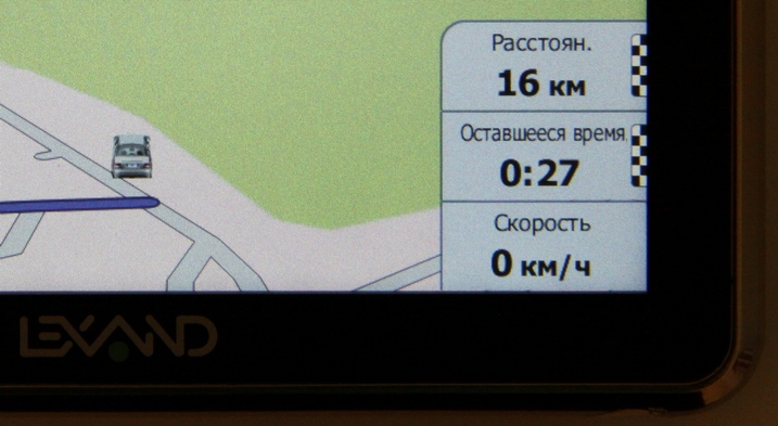
Satellites receiver catches very quickly, even with a cold start for about a minute. I did not measure the exact time of positioning, because before the start of iGo and the choice of address, he usually had time to navigate. The accuracy of determining the coordinates is sufficient for the correct guidance along the route. In the conditions of dense building the signal was not lost.
Externally, the navigator is indeed very thin (13 mm), light and stylish. Explay has models with a thickness of 9 mm, but this, in my opinion, is not so important. In general, the design of all navigators Lexand, uniform and recognizable. He is lucky enough, and I don’t see much change in him.
The Windows CE 6.0 platform, despite its moral obsolescence, is great for navigators. It is traditionally supplemented with a proprietary interface with large convenient icons. The interface is adapted for finger control, but according to my feelings, the responsiveness and accuracy of the touch screen is a bit weak.

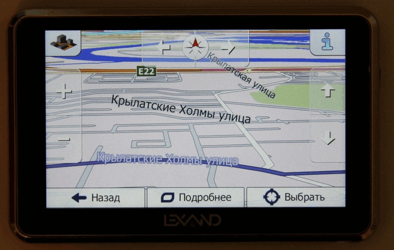
The screen size of 5 inches is sufficient for a comfortable view of the map while driving. The drawing speed of the map is acceptable for a resolution of 800x480, although, of course, scaling in 3D noticeably slows down - it’s better to switch to a plane for this purpose. Previously, I underestimated the high resolution, but now I’ve seen that it is much better than the previous 480x272 standard:
As you can see, even very small inscriptions on the buttons in the lower right corner look perfect. On a high-resolution display, the map can be shown on a larger scale without diminishing the details. It is convenient in a city with a dense network of roads when reviewing the route.
The display has an anti-reflective coating. In direct bright light, the image, of course, fades, but it is possible to distinguish the map.
The second passenger, in that case, of course, sees almost nothing on the side, but there is no great need for this:
Since the screen is most likely TN, viewing angles are not at all its strong point. However, when the direct sun does not fall on the screen, the picture looks soft. Anti-reflective coating works well.
I think a protective film wouldn't hurt, although the screen is said to be protected compared to the ST-610. I, for obvious reasons, did not begin to believe its impact resistance. When pressed, sometimes overflow of crystals is noticeable, and this creates a visual sensation of fragility, although everything works stably.
When driving along a route, at least in iGo, there were no delays with drawing and with voice guidance at interchanges.
I did not use the light sensor, having unscrewed the brightness immediately to the maximum. At night, of course, you can diminish it, but instead I used the nightly color scheme.
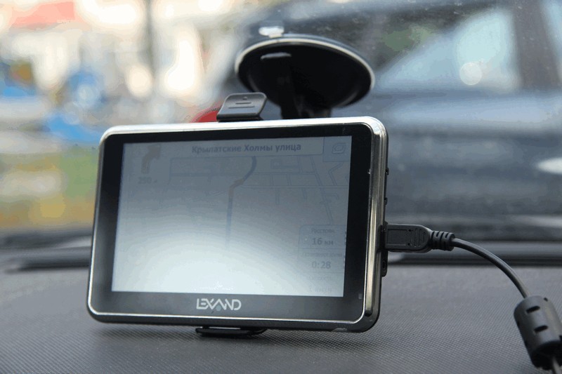
Mount, in my opinion, very convenient. The suction cup holds securely and the mechanism snaps easily. I read somewhere that the device dangles on the bumps, but I fixed it so that the navigator rests on the bottom of the torpedo, so it was securely fixed. The device itself is inserted into the mount until it clicks and then can be very easily removed. Mount can be left on the glass, although, probably, a strong frost would not be good for him. As for the heat, I can say that I had a car for 3 weeks in the open Crimean sun, but nothing happened to the sucker.

You can adjust the position of the device in any plane, thanks to the hinge on the mount. After selecting the optimal angle, fix it with a special bolt.

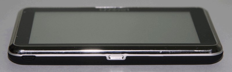
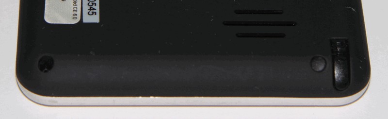
The power button seemed not very convenient - it is difficult to grope it when the navigator is in the holder. And it turns on only after 2 seconds of pressing. Button on the left of the photo:
Since I began to show photos, here are all the other angles.
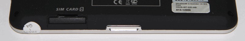
Bottom view: SIM card slot.
The device has a stylus, although in most applications it is not needed. About where it can come in handy
I will tell below.
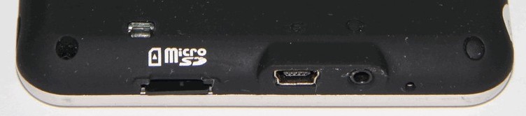
On the other hand, there is a USB 2.0 input, a micro-SD slot, a 2.5 mm headphone jack and a reset hole.
Navigator speaker good, but at maximum volume rattles. I always set the volume to a minimum so that he chatters so quietly, because on a long journey, almost always one of the passengers sleeps. However, if you want to make it loud, you can bring the sound to the car acoustics. It should be better, but I have not tried.
Charged by USB from the cigarette lighter or from the computer (connector one). It would be nice to have a network charge, but if necessary, it is easy to buy extra.
It works autonomously for a long time, although I certainly did not measure it. A decent battery - 1450 mAh. Declared to work up to 2 hours with a maximum illumination and up to 4 - with a minimum.
Installation and updating of navigation software
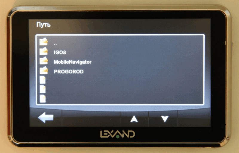
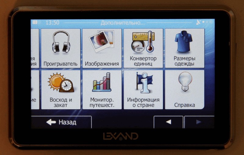
Lexand has long done a very obvious and convenient thing: the regular ability to run any navigation program. In case of problems with one on a trip, you can simply launch another, which is either more stable or has the best map in your area. And they wrote a simple MobileNavigator shell with shortcuts for the most popular navigation programs. It is configured in a text file, where you simply list the paths to all the necessary programs on the memory card and assign shortcuts to them. After the trip, I thought that this way you can run any program, not just navigation. It looks like this:
Unfortunately, even such a simple shell has two minuses. First, it is very difficult to close the MobileNavigator window - the small arrow in the bottom corner is so small that it is almost impossible to hit it without a stylus. Besides, it seemed to me that the accuracy of pressing in the corners of the screen is worse. And, secondly, as seen in the screenshot, the first label is not displayed. I tried to change their places in the configuration - anyway, the problem is with the first one. Developers, correct this annoying error, please.
Having a device of 128 MB of RAM allows you to run almost any heavy navigation system. At 2 GB of internal memory, you can write weighty Navitel, and there will still be room for a couple of other, more compact systems. And if you install a micro-SD card (up to 16 GB is supported), then, if you wish, you can take along maps of the whole world.
Before testing and trying to find defects, it would be good to upgrade all systems to the latest versions. I did not update the navigator firmware and generally did not quite understand if it could be done outside the service center. But the navigation software can be updated.
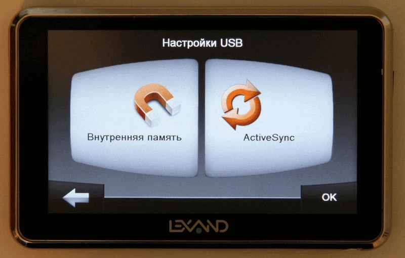
As I have already mentioned, the USB connection refused to work for me at first, and since Navitel was recorded in the internal memory, I could not update it then. I did it after returning by connecting a normal USB cable.
There are 2 options to choose from: USB Mass Storage and ActiveSync. True, the menu with the choice of these options is buried very deep in the depths of the interface:
I apologize for the screenshots from the camera - I tried to put the program MyMobiler, which copes with this perfectly. But before launching, she should install a mate on the device, but for some reason she failed to do this. Perhaps there is some kind of protection, I did not understand.
In ActiveSync mode, the files of the operating system are visible, and the internal memory is located in the DataFlash folder. In USB Mass Storage mode, we receive two connected partitions on the computer, displaying the internal memory and an external micro-SD card.
USB copying speed from the internal memory of the device is 4-6 Mb / s, from the external one - 6-7. Quite decent and more than enough to update programs.
The device was installed "PROBOROD" 2.0.3037 with maps 2.0.017.20101210 and "Navitel Navigator" 3.5.0.1702 with a map for 2010.08.10.
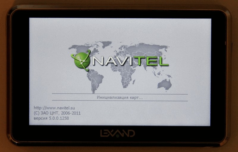
Update Navitel was not so easy. You must first register your device on their website and enter the license number, after which you will be able to download the program from your personal account. I was surprised that the Navitel version numbers for different Lexand devices are different. Navitel update to 5-ki for Lexand was announced in March 2011. I downloaded and installed version 5.0.0.1258. Fresh maps in NM3 format are downloaded separately.
Since PROGOROD turned out to be easier. The site has a fresh version 2.0.3044 with maps 2.0.022 dated 05.31.2011. Download it and write it to a memory card or ROM, deleting the old version and leaving the file with the license.
Citigid did not install, there was no license for it. According to reviews, they lead the quality of navigation in the north-western region.
Just in case, I will mention that with a license, all updates are free.
Testing and comparing navigation software
iGo Primo
I can do nothing, but iGo I like an order of magnitude more than any other navigation program. The speed of work, excellent support along the route, quick search for an address (with almost no delays), a well thought-out interface with a minimum of garbage on the screen and without unnecessary thingies, fast routing, stable work - everything is perfect for me. And with the Primo version it became even more convenient, although I expected it to slow down and be unstable.
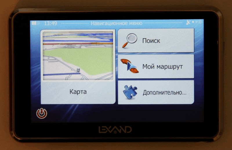
iGo has a very convenient and intuitive menu:
And for the convenience of displaying a map, in my opinion, it has no equal:

But I still tried not to prejudice to assess the quality of Navitel and Progorod.
PROGOROD
I have already tried PROGOROD about a year ago. Since then, the interface has changed dramatically. It has become more comfortable, similar to the iPhone:

It is evident that the work is very active. Even after upgrading from 2.0.3037 to 2.0.3044, interface improvements were noticeable.
But I can not fail to mention the annoying thing: it hung on me quite often. This basically happened when calculating the route and once at the close of the program. And after the update, the situation, unfortunately, has not improved. Here a stylus came in handy several times to click on Reset. I do not know what is the cause of these freezes. The navigator is hardly to blame with its hardware, because iGo and Navitel worked stably. Guys, try to increase the stability of your system, and it will have every chance to become the most successful among Russian developments.
I traveled a little with PROGROAD in Moscow and a couple of times I found a problem with the cards: he offered to turn where it was possible to go only straight.
The speed of work looks very good. Slightly slows down when typing the address, but you can live.
When I first started with the default settings, it gave me a map so cluttered that it was very difficult to navigate the route after iGo. I had to turn off the display of houses and some other beautiful things, after which it became much more convenient and faster. I do not understand why we need houses on the map, and even more so three-dimensional. It is perfectly possible to do without them. They only interfere with the perception of the route when driving and blocking the road from the driver. Although, sitting in a chair at the computer, the developers, apparently, it seems that the houses are more comfortable and more beautiful.
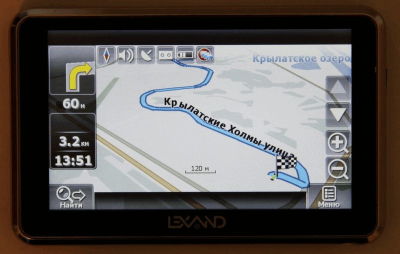
Here is a display of three-dimensional junctions really useful, especially for multi-level complex intersections.
There is a small note to the interface: why take up such a large area of the screen under the buttons and at the same time make the buttons themselves small and incomprehensible:
Navitel Navigator
Now about Navitel. I tried it not for the first year. Previously, he often hung and generally worked slowly and unstable. In the latest version with stability things are much better. In my opinion, he never hung up with me.
But they have another problem - the speed of work. What is most annoying is the brakes when typing the address. After clicking on the next letter, an hourglass appears somewhere for 1-2 seconds. Gentlemen developers, you never drove behind the wheel? Can you imagine that sometimes it is necessary to type an address on the fly in a dense stream? Does a search in a database of 3,000 street names for Moscow really take up so many resources from a 500 MHz processor? I was also very surprised by the need to print a period and a space between the house number and the building. Although it was only in version 3.5, in the 5th one, finally, they realized the uselessness of these clicks.
As for the map display, this is, of course, an amateur one, but I don’t really like Navitel. The screen is cluttered with unnecessary buttons of different sizes and styles. Tell me, why does the driver have letters with shadows? Why mist the map on the horizon? At the same time the route is drawn by rather clumsy lines. It is better to throw more power to accelerate the rendering. Because in some places it’s just a nightmare - constant twitching and blinking of the entire screen with all the inscriptions and house numbers.
For a car navigator, the most important thing is a simple and fast interface. All the rest is secondary. The driver usually does not have time to look at all the beauty. Looking at the screen should take no more time than in a mirror. During this time, you must have time to read and understand all the important information.
But on the other hand, Navitel has one big advantage: excellent maps of Russia, judging by the reviews on specialized forums. Here, indeed, there is an active work on improvement and refinement. And, of course, cork service. Unfortunately, I only managed to make sure that it works, but did not use it.
Finally, I propose to compare the sizes taken by the distributions of the programs named:
- PROGOROD with maps of Russia: 500 MB
- Navitel with maps of Russia: 1770 MB
- iGo Primo with maps of Russia and Ukraine: 207 MB
Yes, iGo also has three-dimensional houses and even landscape maps. And they occupy a huge amount. But they can be put separately and at will. To navigate, the silhouettes of the houses, which I suppose eat up the most space, are not needed. All you need is an address and one point with coordinates.
GSM / GPRS operation
Lexand has 3 models with support for SIM-cards (Pro index), but 515 Pro HD is the only one with high resolution. For those who do not need GSM, there are several models that support traffic jams via Bluetooth.
Without a SIM card, navigation works fine, contrary to reviews. Apparently, the firmware was fixed, although the problem message still hangs on the site.
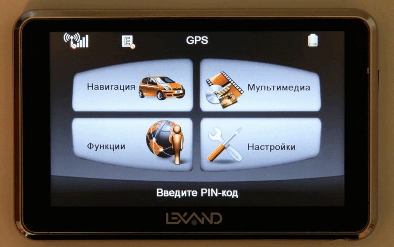
When turned on with an inserted SIM card, you are prompted to enter a PIN code, but how to do it is not clear on the go. I even spent half an hour on the Internet, until I realized that I had to open the GPRS item at the 2nd level of the menu nesting, which for some reason is not always active, even with a SIM card inserted.

The SIM card gives the navigator several useful features. Firstly, it is the ability to load traffic jams in real time. Perhaps this is the most important and obvious function. But even here you can get by with a Bluetooth phone.
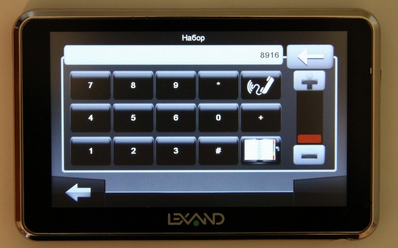
Everything else, in my opinion, is secondary. Yes, it is convenient to call and send SMS on a trip from a large screen and on-screen keyboard. However, if dialing is implemented in Lexand well,
then the SMS uses the standard microscopic Windows CE keyboard, which can only be pressed with the stylus.

As for the Internet, here I would never use it if I had at least some laptop, tablet or even a smartphone with me. Some ancient Internet Explorer is installed on the navigator, apparently going normally with Windows CE. It is simply impossible to do anything in it without the stylus: the same on-screen keyboard as when typing SMS, the wretchedness of the interface and the almost complete inability to close the browser window - the close button is microscopic and, moreover, it is almost never pressed on the first attempt - because of the poor sensitivity of the screen in the corners. There was a lack of any hardware “Back” button.
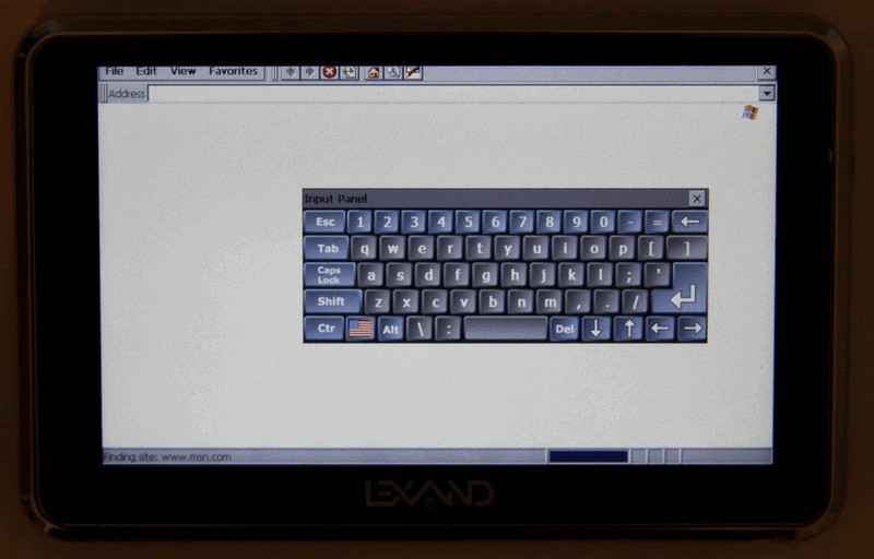
Internet somehow terribly slowed down. Even the lightweight page of Yandex (ya.ru) opened a minute. I thought that this was due to the unstable connection in the apartment, but the MTS-ovsky 3G-modem sticking up next to the computer worked perfectly. There are 2 options: either the device has a very bad GSM antenna, or the GPRS of our operators is really so slow and overloaded. People, how do you manage to use Yandex-cards from non-3G phones?
In general, I repeat: GSM / GPRS on the navigator is needed only for receiving traffic jams. And even in this case, due to the terrible quality of GPRS, it may be preferable to use Bluetooth, because a 3G phone works much better.
Side functions
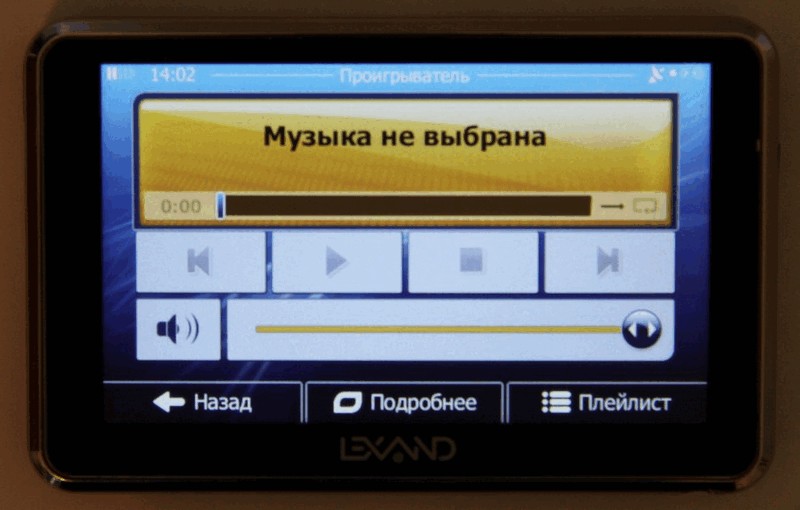
The functions of viewing video, music, photos and texts in all navigators are traditionally very poor and slow. They exist, most likely, for a tick, so I will not dwell on them in detail.

You can output the sound from the navigator through the built-in FM transmitter to the on-board acoustics of the car by tuning the same frequency on the navigator and on the car's FM receiver.

I will not restrain myself from mentioning iGo again. In the Primo version there are built-in utilities for working with multimedia. They are made in the style of iGo itself, i.e. nice and comfortable:
With their appearance, iGo is quite possible to use as a full-fledged shell of the navigator, launching it at system startup. Although the possibility of choosing a navigation system is better to leave.
findings
Lexand is quite active in the market of navigators, releasing devices equipped with the latest. The main thing - do not make blunders with quality that may affect the reputation. All declared functions should either work perfectly or should not be implemented at all.
So, in short, the pros and cons of Lexand Si-515 Pro HD.
Advantages:
- High screen resolution
- GSM / GPRS module for receiving traffic jams
- Convenient mount
- Established ability to run any navigation system
- 128 MB RAM is enough for heavy navigation systems.
- Quick satellite orientation
- FM transmitter
- Capacious battery
Disadvantages:
- Not very responsive resistive screen
- Minor tweaks in Lexand brand shell
- No AV-IN input for displaying images from the rear view camera (available in other Lexand models)
- Flaws with the Internet browser and sending SMS
- Not quite clear problem with USB connection - I suspect a bad wire
- Multimedia features rather for show; It would be good to give the opportunity to run third-party multimedia programs.
In general, there is something to improve, but I do not see any fatal flaws. Next time I will try to take on the test some of the latest models with a faster processor, new design, and, judging by the parameters on the site, a better screen.
Comparison line of navigators Lexand
Unfortunately, the manufacturer does not publish on the site a comparative table of its models. Without such a comparison, anyone will be confused in the choice of 23 options. Therefore, I will try to close this gap.
All Lexand models have several common characteristics:
- Micro SD card support up to 16 GB
- 128 MB RAM
- Lack of Wi-Fi
- The ability to run any navigation system
- In all the latest models, the headphone jack is 3.5 mm, and in earlier models it is 2.5 mm.
Comparative prices are mainly taken from auto-gps.ru. Prices there are not the lowest, but in the presence of almost the entire range. Missing positions are supplemented with Yandex.Market.
Good luck with your choice, reliable navigation and exciting travels.
Source: https://habr.com/ru/post/123595/
All Articles