GPS monitoring - control "route" transport
 Greetings to you, Habr! For a long time (since March 1 ) we did not write anything, but only worked, worked and once again worked. We want to share our news, developments, and show how unique functions that are not provided even on a paid basis by some GPS monitoring companies can be obtained from us for free. On the functions of controlling the passage of routes, grouping vehicles into groups, versions for mobile phones with the function of reports and much more - read on.
Export tracks to * .GPX, import objects from * .CSV
The function was requested by users to use or process tracks in third-party programs, everything is simple. Import of objects from * .csv was made to map groups of objects (shops, retail outlets, for example) and use them further for laying a route, and control their visits (more on this later in the text).
Vehicle grouping
Often there is a need to create and control groups of the same type of vehicles, for example, in the list of 20 units, half of which are excavators, and half - transport serving these excavators. Also available now is the generation of group reports for each group separately, i.e. flies - separately, cutlets - separately.
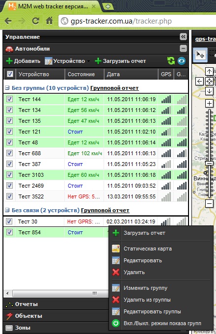
')
Now available and "tracking" the selected vehicle on the map, clicked "blue eye" and the map follows the machine.
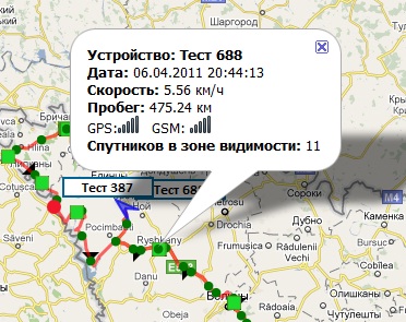
Changing the module rendering tracks - 4
From the requests of users, it became clear that it is important not only to understand the state of the object at the moment, but also to know where and how the sensors behaved after the fact, however - after we output the entire information about the object at that moment when you hover over the reporting track. It looks like this:
Routes
Our longest development, at the same time the most interesting and difficult. Very briefly, you can tell the following way: compliance with a specific time schedule of movement between given points, at a certain time, by a certain means of transport (or “non-transport”).
On this tab - I would like to dwell in more detail. You can bring a lot of situations from life - from a banal visit to certain outlets by a merchandiser, fresh morning bread delivery to points of a bread-baking plant, or following a certain route by public transport.
As already mentioned above, we have import points, which in turn can become control points on the route, we have a starting point, a number of points that we imported, we create a so-called route sheet. Points can be either “control” - the location and parking in which, according to the schedule, is mandatory, and “pass-through” - which the GPS device must “visit”, but parking there is not required.
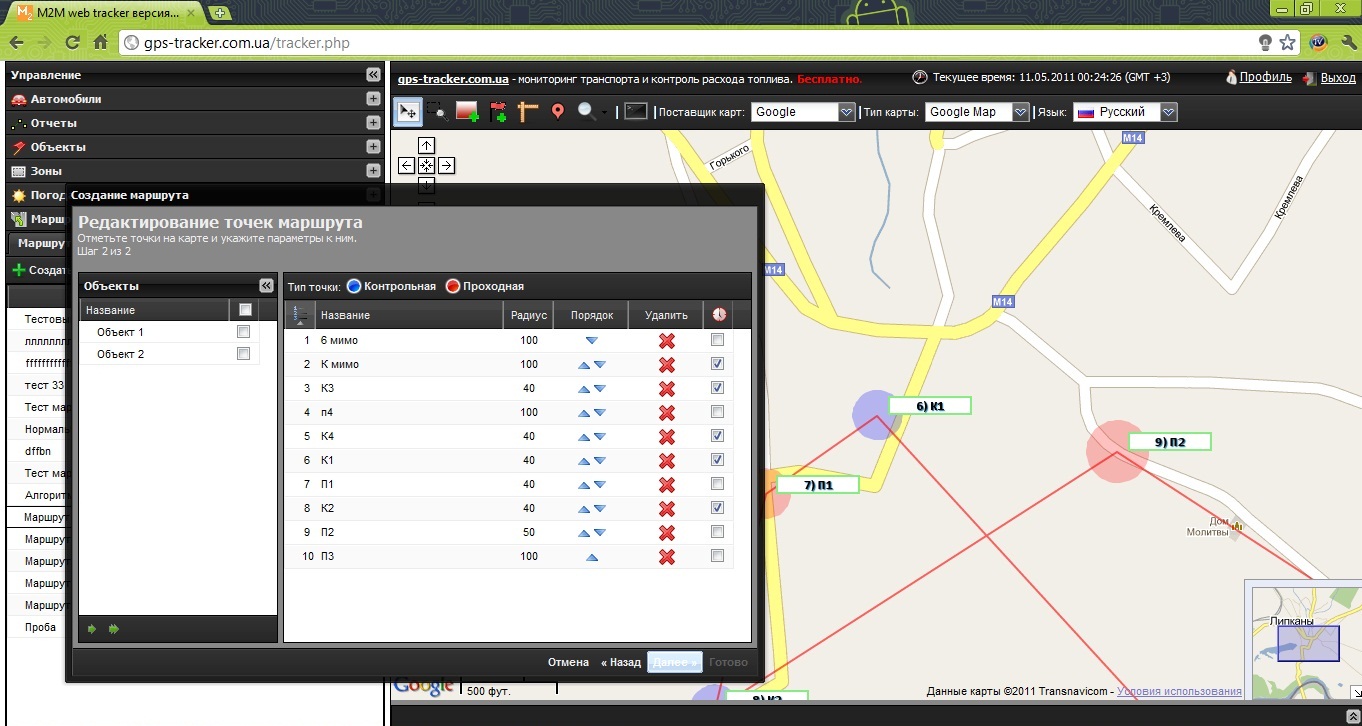
After drawing up routes, we compile a vehicle movement log, in which we write the following basic parameters:
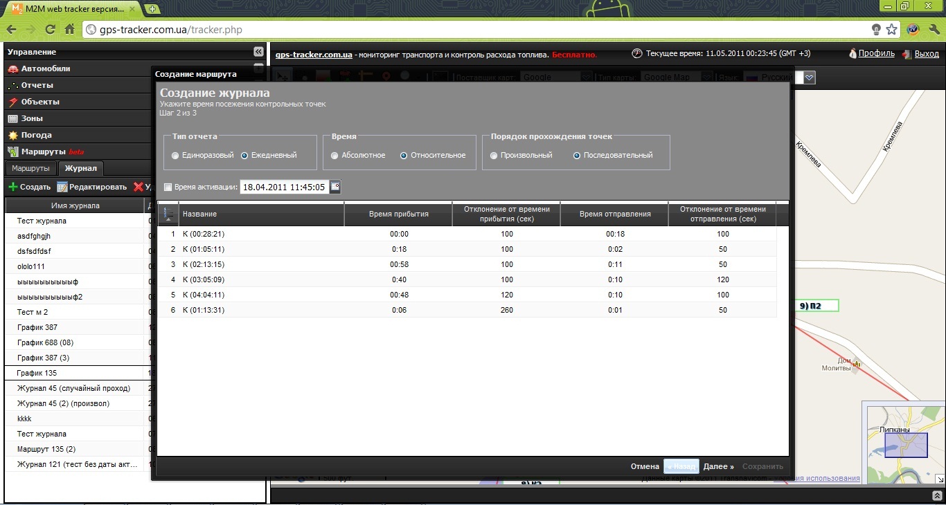
Report type - daily or one-time, i.e. regular route with the same schedule or one-time for a particular case taken.
The time of arrival at the points is absolute (i.e., we set the exact date and time of each control point visit, the delay is recorded in the table) or relative, in this case we set the time that will pass after the route is activated, when each point should be visited (for example 5:35 - means that it should take 5 hours and 35 minutes before the point has been visited).
The order of visiting points is sequential or arbitrary. With an arbitrary type, time is not strictly regulated, and the main task is to visit all points at a given time interval (as a vivid example, visiting a sales representative with a GPS tracker in your pocket during the working day).
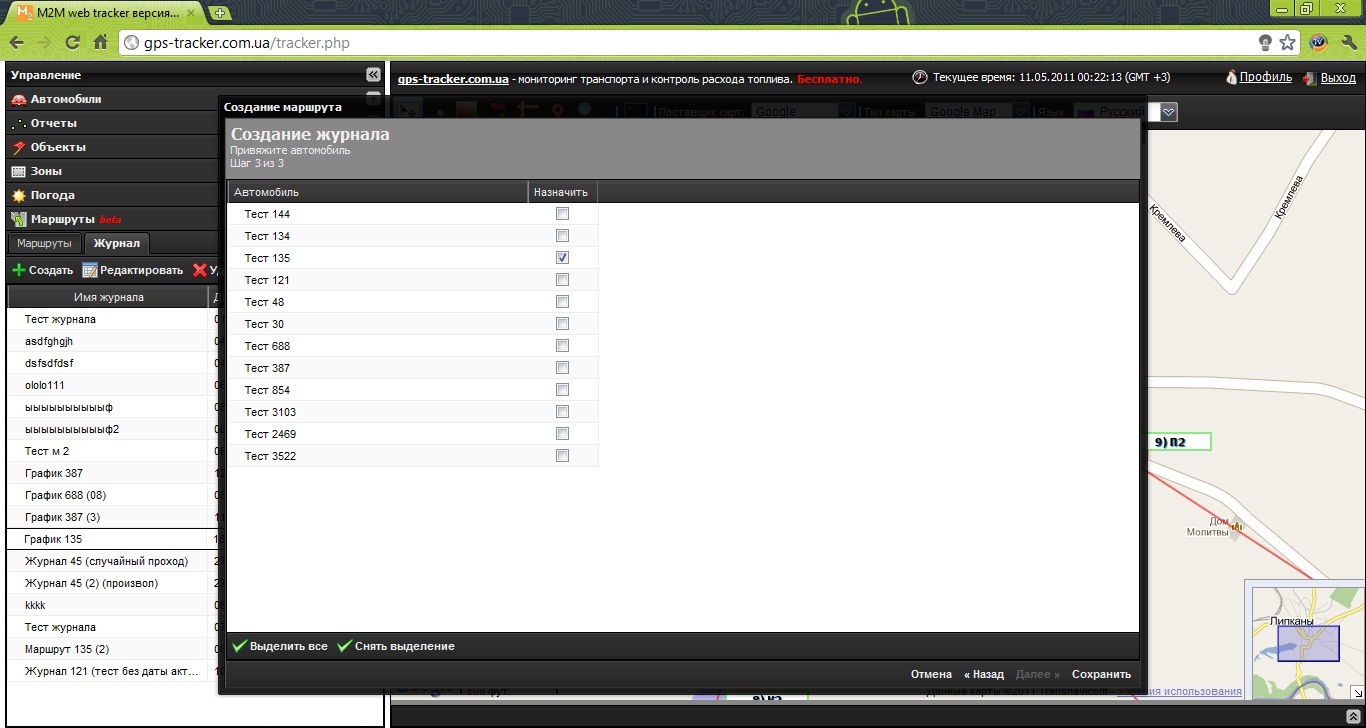
Well, the last step - binding to the route and schedule of the vehicle:
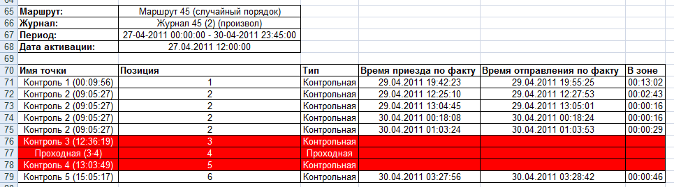
After passing the route - the user can request a report in * .xls format about passing (or not passing) vehicle checkpoints, in the figure red points that have not been visited are highlighted.
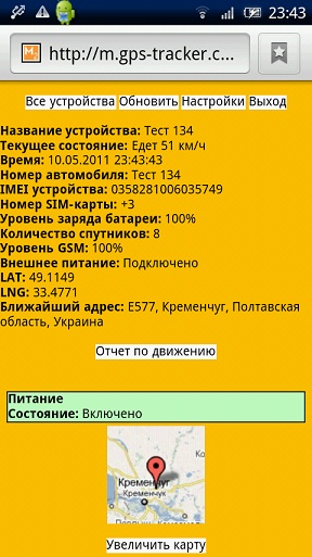
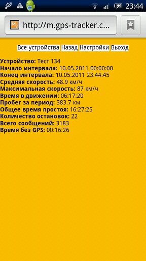
Mobile version of our service
Well, and lastly, now you can watch devices from any mobile phone. A light version of our service is available for all phones that can work with Opera (Mini). The main features of our service:
- Minimal traffic consumption (net html + viewing of the location on the mini map) will allow to obtain data on the current location of the vehicle extremely quickly and at minimal cost.
- Work with sensors - full monitoring of the status of sensors that are connected to the device directly on your mobile phone.
- Work with arbitrary types of maps to choose from (Google, OSM)
- Reports on movement (day, week, any segment to choose from) - no one has this. Someone may say that the feature is useless - but sometimes it is extremely convenient to have at hand information "here and now."
A couple of screenshots:
Total
We continue to make a product that is in demand. We invest our strength and we hope that the end user needs what we do. After 2 months, the project will be 1 year old, this year we have done a lot, both in terms of functionality, and expanded 4 times the number of supported devices (about 120 device types are currently supported, including both domestic and foreign manufacturers). We listened and fulfilled all the "wishes" of our users who hope to stay with us.
Stay tuned!
Your www.gps-tracker.com.ua
Source: https://habr.com/ru/post/119071/
All Articles