Convenient GPS monitoring
 Good day, dear readers. Our last report to the public was 10/18/2010, we worked a lot and now in your court we present a qualitatively new product that is a cut above our younger brothers, we changed the work of the main modules, moved to a fast server, made our WM application. There will be pictures (clickable).
Static map for insertion in a blog or on a site
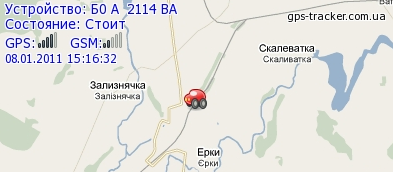
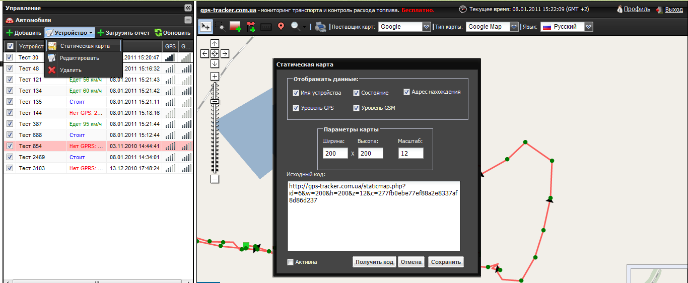
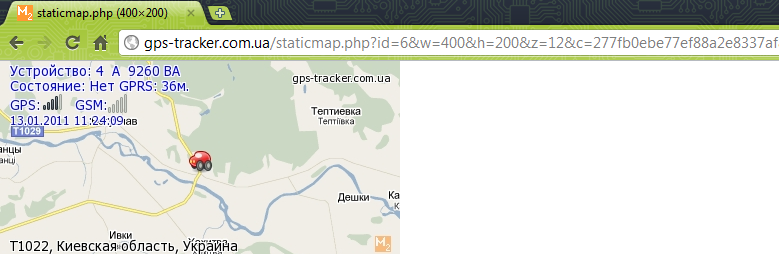
Especially for those who want friends or relatives to know where he is at one time or another, the following has been done: the “Static Map” subsection has appeared in the “Device” section. The tool serves to generate and activate a link, which with the necessary parameters (selected) saves the file, which can then be inserted into a blog, website or 1C-Accounting. The file size is chosen, however, like all other parameters. The time for updating the picture is every 10 minutes, which should be sufficient for such a function (according to the wishes of the users, this is not what we decided).
')
When clicking on the link with your hands or a script, we see such a mini map (ready for further work):
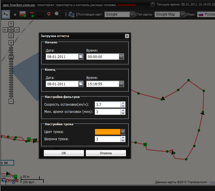
Complete change of the track rendering module
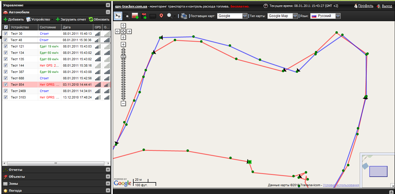
“There are no more faceless worms on the map!” - we thought and completely rewrote the module that was responsible for drawing the tracks. Now, when building reports on the track, you can see the direction, the speed in points, it also became possible to set the width of the track in the reporting form. An important innovation was also the display on the speeding track. For each vehicle, the boundary speed is adjusted separately. It became more convenient to work with tracks during group reports - now intersecting routes are much easier to identify.
Over speed:

Group reports:
Refinement of the module working with zones
In previous articles we have already talked about the module for working with zones.
This time we updated the existing module, now when you hover over the zone, a tooltip shows which devices are tied to the zone and which events they are tied to (Input or Output). We have already finished with zones, but if our users have suggestions, we will listen and realize it (a common thing).

Ruler
A simple tool for measuring distances on maps, a trifle, and in applications from users was a long time ago. The icon with the image was in the interface for a long time - now it is active. Measures quite accurately (we checked).

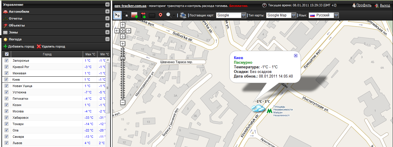
Weather on the map
One of the functions that more bears the character of “convenience” is the weather information provided by our partners with a relatively accurate forecast (compared with the gismeteo). When you hover over the weather icon, it shows the update time. All Ukrainian cities and most of the Russian Federation are available. Just add your city under your login and when viewing information about the vehicle - there will always be actual weather. The next stage - the weather on the main roads, weather warnings.
Getting started with CAN bus
After adding support for these fuel level sensors and fuel consumption sensors, we are currently working on supporting CAN bus data (STEP II, STEPP III), data on the level of fuel in the tank, average fuel consumption per trip. Will be available soon in reports. During this time, we also added a number of new devices, including not only China (the new analysis module of “non-binary” parcels allows us to tie new devices extremely quickly), but also a number of devices produced in Russia and Ukraine (our service has become a tool for a new wave of sales of devices namely domestic producer).
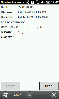
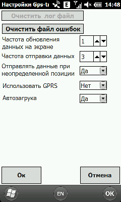
Windows mobile app
It has become a tradition at the end of the post to write about applications that are created for our service by third-party programmers. (It brought $ 3000 to the author of the android application, proof ) But today it’s not about him, now we have an application for WM available for download that turns a communicator or PDA into a GPS tracker that has all the functions for remotely monitoring a device’s movement. All functions are standard and hone to the maximum - sending data after the restoration of communication, a black box, work on GPRS and Wi-Fi. The author of the application is a habrazhitel and just a great person Dmitry Dashkevich , discussion and bug reports in our forum .
The design is old school, but skins for beauty lovers are ready.
QR code on the program. We will be happy and grateful for the tests.

Total
We moved to a faster server, we are constantly updating the functionality and try to make the service better. Thank you for supporting us and directing your wishes and Wishlist on the right track. We stay free and continue to delight you with new modifications!
Sincerely, the team of GPS-tracker.com.ua
Source: https://habr.com/ru/post/111581/
All Articles